A Highway of Water
21 Sep 2014
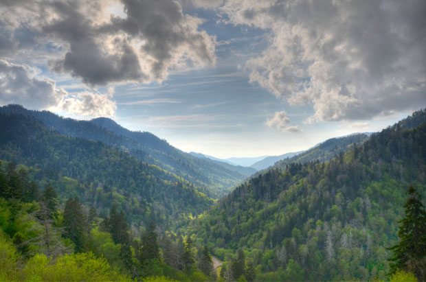
Cruising the Atlantic Intracoastal Waterway offers a trip through American history, and extraordinary views of expansive wildlife refuges, remote islands and friendly people who make their living along these waters.
By MARIE SEBASTIAN
As a child, I would examine the maps that made up the middle pages or back flaps of pamphlets and guidebooks encouraging tourism in South Carolina, and it was on these pages that I first encountered the term Intracoastal Waterway. However, growing up on the coast and having a family home right outside of Pawleys Island―and later, attending college in Myrtle Beach―I took the term for granted. I had no idea about the relevance of the Atlantic Intracoastal Waterway, nor its length, nor the number of people who passed through my homeland on this watery highway.
The Intracoastal Waterway ― or ICW for short ― is actually made up of a couple different parts: the Gulf ICW and the Atlantic ICW. Our portion, the Atlantic ICW, moves roughly from Norfolk, Virginia, down to the Florida Keys ― and through the Carolinas, of course. It's a combination of bays, marshes and rivers, plus a few man-made canals. As any avid boater in this region knows, the ICW offers a fantastic way to see much of the East coast without having to navigate the ocean.
Since the ICW continues to be a commercial waterway, and you'll probably pass boats of all sizes, inexperienced seamen and sea women will want to educate themselves regarding the different mile markers, places to fuel up and places to have fun. It's helpful to know the principles of navigation before embarking on an ICW trip ― under certain circumstances, it can mean the difference between safety and danger.
In his unpublished manuscript, “An Explorer's Guide to the Waccamaw River,” Dr. Richard Collin remarked, "Rather than change the [navigation] system every few miles depending upon the flow of water, the planners of the ICW assumed that Florida is the ‘home’ to which we're returning." Thus, sailors of the ICW are instructed to pass to the left of the square red markers if they are headed south toward the Sunshine State. On the other hand, if you are travelling north toward Virginia, the rules are just the opposite.
Voyagers ought to equip their vessels with safety supplies such as a marine radio, maps, personal lifesaving devices, fire extinguishers, flashlights, batteries, first aid and, if their boat is large enough, a copy of the U.S. Coast Guard navigation rules.
If you're traveling for fun, you'll probably want something to guide the voyage other than maps and navigation laws. One of the most popular books is “The Intracoastal Waterway: A Cockpit Cruising Handbook,” by Jan and Bill Moeller, which has been updated several times.
As far as navigating the South Carolina portion of the ICW, Charlestonians will want to check out a few other fun, and beautiful, places along the way, whether they've signed up for a tour or are boating themselves. Here are a few spots of interest for docking your craft, having a bite to eat or a cocktail and checking out the scenery.
Around the Lowcountry
The Bohicket Marina, located between Kiawah and Seabrook islands, is a fine place to dock in the Charleston area, with more than 200 wet slips, as well as dry storage. Visitors for the day or overnight pay a modest price per foot and receive amenities such as Wi-Fi, electricity, bath facilities and laundry. A variety of restaurants are nearby, including Rosebank Farms Cafe, Red’s Icehouse and Fischer's Sports Pub and Grill.
The Edisto Marina, located on the beautiful Edisto River, is one of the closest ports to the actual ocean and is also the only public boat ramp at Edisto Beach. It's a bit more rustic but absolutely worth a trip. Services at the marina include ethanol-free gasoline, beer, snacks, gifts, bait and professional tours of the area. You'll also want to check out the Edisto Marina Governor's Cup Billfishing Tournament, which is held each summer and is a fantastic reason to visit.
North
If you're heading north, Georgetown is a quaint town on the ICW with a charming waterfront to explore on the Sampit River. Park at the Harborwalk Marina and hang out for the afternoon. You can visit well-known restaurants such as the River Room and the Rice Paddy or shop at a variety of boutiques and antique shops ― there's no limit to convenience since the marina is in the heart of downtown Georgetown.
Just a few miles up the ICW is the Wacca Wache Marina of Murrells Inlet on the Waccamaw River. For boaters who've never ventured to Murrells Inlet, a seafood dinner is at the top of your to-do list. We also recommend spending some time in Brookgreen Gardens, between Murrells Inlet and Pawleys Island, which is not only the perfect place to enjoy natural beauty and art but also hosts a variety of programs throughout the year, including horticultural classes and lectures on the local Gullah Geechee culture.
For something more upscale, check out the Grande Dunes Marina of Myrtle Beach, located in the elite Grande Dunes community. You can count on practical necessities such as floating docks, laundry facilities and great restaurants nearby, but Grande Dunes marina guests will also enjoy proximity to the four-diamond Marina Inn, a selection of Myrtle Beach's best golf courses and a private cabana bar on the beach.
South
Those who are headed south from Charleston should check out the Downtown Beaufort Marina, which is right in the heart of town and within walking distance of shops, restaurants, historic homes and comfortable lodging options. Beaufort's Water Festival, a popular event held each July, is a great time to explore this smaller but no less interesting pocket of the Lowcountry.
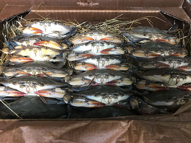
The Shelter Cove Marina boasts the deepest yacht basin in Hilton Head and thus is the perfect place to enjoy watersports such as jet-skiing, as well as deep sea fishing and crabbing. Located in the Shelter Cove Harbor, the marina is close to plenty of entertaining night life as well.
Work in Progress
But even with all the fascinating places to dock your boat on the ICW, the truth is that our beloved highway of water continues to be a work in progress. The Intracoastal Waterway is authorized by the federal government to be 12 feet deep throughout, but there are a few spots that are quite a bit shallower, according to Lisa Metheney, deputy district engineer of the Army Corps of Engineers for the Charleston District.
Metheney and the rest of the South Carolina team are responsible for the 210 miles of the ICW in our state ― from the line dividing North Carolina and South Carolina to Port Royal Sound. The shallowest spots are Breach Inlet, Jeremy Creek and the Ashepoo-Cooshaw Cutoff.
"People ask why we can't just do something about the depth of the Intracoastal Waterway," remarked Metheney. "But funding for our Corps is done through Congress; in order for us to do anything, we need both authorization and appropriation, or in other words, permission and money. As we all know, the federal budget is tight, and there are competing needs."
Metheney explained that although Congress has indeed granted authorization to deepen the shallower spots, financing is still an issue ― and most people aren't aware of the expenses, which include both the actual digging as well as disposal area maintenance. You have to have somewhere to dump the dirt. And even though we all love the ICW dearly, the fact that the Waterway isn't used for much commercial traffic these days drops it farther from the top of the priority list.
"It's all performance-based budgeting," said Metheney. "The AICW falls into the shallow draft, low use category because it's mostly used for recreational purposes."
Still, Metheney maintains that dredging is necessary and looks forward to being able to complete the project in the near future. Meanwhile, she concentrates on the most efficient use of government funding, which includes saving for dredging projects as well as maintaining the 90 disposal areas that South Carolina already has. Recently, for example, the Corps took $500,000 to build oyster castles, which will protect two of the current disposal sites from erosion.
"We try to be prudent and effective with the money we're given," she said.
Folks who are interested in donating their time to the ICW cause can look into supporting a group known as the Atlantic Intracoastal Waterway Association (AIWA). The AIWA's purposes are to increase funding for the completion of projects; to collect proper data on the ICW; to keep the price of gasoline and other materials reasonable and to promote the importance of the ICW as a whole. Metheney encourages interested parties to contact their U.S. representatives and senators and share how they feel.
"We know it's frustrating for people who travel the ICW as a highway," Metheney admitted. "And I understand their frustration."
Fortunately, there are a few helpful websites for staying informed in terms of what happens with the Intracoastal Waterway. Metheney suggested visiting the Corps' site at sac.usace.army.mil/missions/navigation for information on navigation, including shallow areas. She also encouraged boaters to share the information when they discover other shallow spots.
Another helpful website, The Salty Southeast Cruisers' Net at cruisersnet.net, is great for breaking news about the ICW, coupons for travel and general camaraderie among boaters.
As for Metheney herself, she doesn't have much time to navigate the Atlantic Intracoastal Waterway outside of work ― but she enjoys the tales of those who do.
"It's a great resource," she said. "I know so many people who love it."