Springtime Ramblings up the Sewee Broad Path
09 Apr 2019
Taking the Scenic Route to Historic McClellanville and The Village Museum
BY SUZANNAH SMITH MILES
Spring has sprung and it’s time to take to the roads and rejoice in the beauty and history of the Carolina Lowcountry. This trip takes us north; up Highway 17 past Mount Pleasant, to places with intriguing names like Copahee, Wappetaw, and Awendaw. We’ll ultimately alight in McClellanville and take a peek inside the Village Museum, where history is shared in one of the most charming settings imaginable.
For thousands of years, the coastal Indian tribe called the Sewee (also spelled Seewee) lived along this part of the coast. “Sewee” is said to mean “island people” and the offshore islands of Sullivan’s Island, Isle of Palms, Dewees, Capers and Bulls were originally known as the “hunting Islands” of the Sewee. Highway 17’s predecessor, the Georgetown Stage Route (also known as the King’s Highway) was generally built atop the Sewee Broad Path, an ancient trading route that went all the way to Canada
It is only a ten-mile drive to the area the Sewee called Copahee (the “-ee” at the end of a word denotes water) and Copahee Sound is right offshore. It’s only a short side-trip to see this gorgeous expanse of marsh and water. Take a right from Highway 17 onto Gadsdenville Road (shortly past Whitehall Terrace) and follow the road to its dead-end at a public landing. Here is a jaw-dropping panoramic view of what the early settlers called “The Great Marsh” with Capers Island on the horizon. This pristine setting marks the beginning of the 66,287-acre Cape Romain National Wildlife Refuge.
After Copahee comes Wappetaw. Here you’ll find the legendary Seewee Restaurant at 15-Mile Landing Road, beloved for its down-home ambiance and the delicious meals prepared in Miz Mary’s kitchen. This is honest-to-goodness Lowcountry cooking—hot, homemade hush puppies, daily-made okra soup and shrimp, oysters and fish caught from local waters.
Practically at the restaurant’s back door is the historical marker noting the site of the original Wappetaw Meeting House, built to serve the settlers from Massachusetts, (including Miz Mary’s ancestors), who arrived here in 1696. Many are buried under the ancient oaks in the churchyard, all which now remains.
Several miles further up Route 17 is the Sewee Visitor and Environmental Education Center, a “See-Touch-Hear” mini-museum with a focus (and superb animal dioramas) on the natural history of the Cape Romain Wildlife Refuge and Francis Marion National Forest. A bit further up the road is theSewee Shell Mound Interpretive Trail, a walk to a 4,000 year-old shell ring (also an 800-year old clamshell mound) created by the ancient Sewees for ceremonial purposes. Bring hiking boots and bug spray, and don’t forget the camera – birds and wildflowers abound.
You are now in the area called Awendaw, also historically spelled as Owendaw and how the name is pronounced by locals. Not far from where the highway crosses Awendaw Creek was the location of Avendaughboo, the Sewee’s main village.
As you drive on, remember that the surrounding lands have been working farms since the beginning of colonization. After Awendaw you will pass Buck Hall, Laurel Hill, Doe Hall and Tibwin Plantation, established by Barbadian settler John Collins in the late 1690s. Portions of this former rice plantation are now open to the public as the South Tibwin Hiking Trail. Here you can hike or bike, traversing wild woods, broad marshes and lowlands. Definitely bring bug spray, drinking water, a first-aid kit and perhaps a compass to keep your bearings. Don’t be surprised if you see Mr. Snake or Mr. Alligator. They’re both there, for this is a Lowcountry setting at its uninhibited best.
Only a few miles further the blinking traffic light marks the junction of Highway 45. A right turn takes you onto Pinckney Street and into the coastal village of McClellanville, population 1,020 or thereabouts—not many more than when the Sewee chief named King Jeremy resided on these lands. Jeremy Creek, home to the village’s shrimping and fishing fleet, still retains his name.
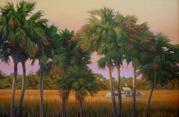
Describing McClellanville as “picturesque” is an understatement. The streets are narrow (some still unpaved) and lined with majestic oaks dripping in Spanish moss. The town differs little from the 1860s when landowners Archibald McClellan and Richard T. Morrison began selling waterfront lots to wealthy Santee River rice planters as places to build summer cottages. Many of these original homes still stand, charming clapboard residences fronted by neatly kept gardens and white picket fences.
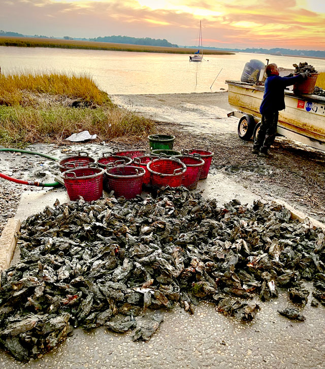
The village’s “business district” is a short block long, the center of which is the laid-back T. W. Graham & Company, a former mercantile converted into a restaurant specializing in seafood. Indeed, shrimping and oystering are the town’s main industries. The shrimp trawlers docked on Jeremy Creek at the end of aptly named Oak Street are not only picture-worthy but hard-working vessels.
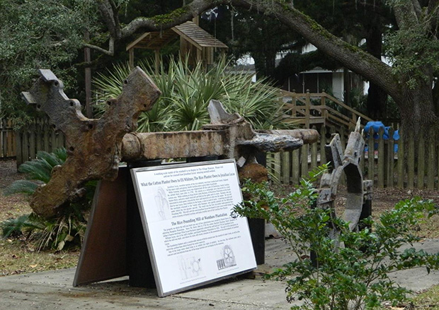
Capturing all is The Village Museum, located at the far end of Pinckney Street near the public boat landing. Called by some the best “small” museum in the state, the collection may be minor in size but is great in the fullness and quality of its displays—from early Sewee arrow points to artifacts from 18thcentury Santee River rice plantations.
“The model of the shrimp trawler is probably one the school kids like best,” says museum director Randal McClure. “That, and the alligator skeleton head,” he laughs, adding, “giving tours to school groups is one of the things we enjoy most. There is so much to see and talk about. They really enjoy coming here.”
McClure, who took over as head of the museum last year from founder Seldon “Bud” Hill (now director emeritus), is ideal for the position. After moving to McClellanville in his early twenties, like others he had a stint working on shrimp boats. He eventually became a professional real estate agent and is a land surveyor. For many years he assisted the late historian Agnes Leland Baldwin as she researched historic properties and plantations. McClure readily admits that there are few places in the area that he doesn’t know personally or has at least walked.
One of McClure’s main goals as director is the digitization of the museum’s extensive historical and genealogical archives. “Frankly, it is an honor to be able to continue Bud Hill’s incredible work and ensure the preservation and protection of all that has been collected over the past 20 years. Digitizing these records will be a major activity for us in the upcoming two years. We look forward to making the archive available online for everyone to enjoy. In the meantime, our doors are open. We invite everyone to come visit.”
Contacts and Other Sites to Explore
Hampton Plantation - https://southcarolinaparks.com/hampton
1950 Rutledge Rd, McClellanville, SC 29458 - (843) 546-9361
This colonial-era rice plantation on the Santee River was visited by George Washington. Grounds are free. House admission: $7.50/adult; $3.75/S.C. Senior; $3.50/youth age 6-15; Free for children 5 & younger. From Highway 17, turn left onto Rutledge Rd, entrance 2 miles on right.
Hopsewee Plantation - https://hopsewee.com
494 Hopsewee Rd., Georgetown, SC 29440 | Phone: (843) 546-7891
Built circa 1740 and birthplace of Thomas Lynch, Jr., signer of the Declaration of Independence. Located on the north side of the Santee River; signs on Highway 17 point the way. Hourly tours from 10 a.m. to 3 p.m. They close for private events and weddings so call in advance.
Santee Coastal Preserve - https://scgreatoutdoors.com/park-santeecoastalreservewma.htm
220 Santee Gun Club Road, McClellanville, SC 29458 - 843-546-8665 - E-Mail: lynchg@dnr.sc.gov
This former plantation and hunt club on the South Santee is now a wildlife management area; boardwalks meander through former rice fields and wetlands. Free admission and camping; definitely bring mosquito repellant in warm months.
Seewee Restaurant - seeweerestaurantinc.com
4808 N Hwy 17, Awendaw, SC 29429 - (843) 928-3609
Sewee Center: Visitor & Environmental Education Center - www.fws.gov/refuge/sewee_center/
5821 Highway 17 North, Awendaw, SC 29429 - Phone: (843) 928-3368
Sewee Shell Ring Boardwalk - www.fs.usda.gov/recarea/scnfs/recarea/?recid=47387
Directions: Take US Highway 17 north to Doar Rd. North (SC Route 432-S), turn right and go 2.5 miles to Salt Pond Rd. Turn right on FS Road 243 and go ½ mile to trailhead. Open Wednesday – Saturday, 9-5. 9:00am – 5:00pm. Free.
South Tibwin Hiking Trail - www.fs.usda.gov/recarea/scnfs/recarea/?recid=47279
Directions: From the Sewee Visitor and Environmental Education Center, take 17 North toward McClellanville for 12.5 miles and look for the sign and entrance gate on the right. For full information contact the Francis Marion Ranger District, 2967 Steed Creek Road, Huger, SC 29450
Phone: (843) 336-3248.
The Center for Birds of Prey - www.thecenterforbirdsofprey.org
4719 Highway 17N, Awendaw, SC 29429 - Phone: 843.971.7474/Toll Free: 1.844.321.1961. Open Thursday-Saturday from 10-5. Call about tours. $8-15; free under age 6.
Town of McClellanville - http://townofmcclellanville-sc.net/history.php
Village Museum - https://www.villagemuseum.com/
401 Pinckney St., McClellanville, SC 29458 - (843) 887-3030
Members, admitted free; Adult non-members - $5.00; children and students free
Groups invited but please call in advance for special pricing