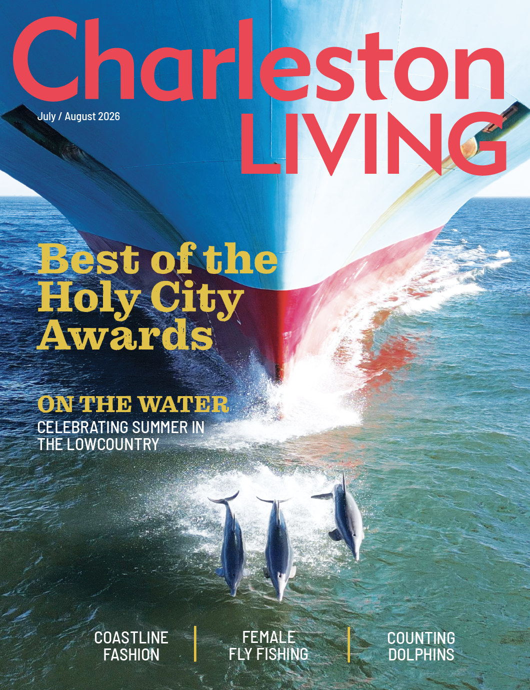
What’s in a Street Name?
05 May 2017
The unique street names in Charleston and their unexpected origins
By SUZANNAH SMITH MILES
Visitors and newcomers are often amused and confused at some of Charleston’s unusual street names—names such as “Legare” and “Huger” that somehow came to be pronounced so they rhyme with “agree.” And the name “Vanderhorst?” The correct way to pronounce this surname (at least in Charleston) is “Van-dross.”
Unusual pronunciations notwithstanding, some of Charleston’s street names are not only intriguing, they have origins that are far different than expected. All offer a glimpse into our city’s never-ending cache of history.
As one might suppose, George Street, which runs from Meeting to East Bay, was not named for King George. The honors go to Captain George Anson, the celebrated British naval officer who was stationed in Charles Town from 1724 to 1735, and for whom the Ansonborough area is named. When Ansonborough was developed as a suburb, five streets were laid out, each named to honor Captain Anson. George and Anson streets honored the man himself. Three others were named for ships he commanded, i.e., Squirrel (now a part of Meeting Street), Scarborough (now part of Anson Street), and Centurion (now Society Street). Interestingly enough, Society Street was not named to reflect Charleston’s well-known high society but rather for a school for orphan boys erected there by the venerable South Carolina Society in the mid-1700s. A portion of Wentworth Street also intersects Ansonborough and was named to honor Charles Watson Wentworth, Marquis of Rockingham, who actively supported the American cause prior to the Revolution.
Beaufain Street, pronounced Bu-fane, honors Hector Berenger De Beaufain, Collector of Customs in Charleston in the mid-1700s. A native of Orange, France, Beaufain emigrated to Charles Town in 1733, where he was noted for his benevolence towards all people. At his death in 1766, he left the income from the rental of his pew at St. Michael's Church and £500 to the city’s poor. Similarly, Council Street was named for Benjamin de la Conseilliere, a member of His Majesty's Council in 1721 and Assistant Chief Justice in 1739.
Though you might think Cannon Street was named for military presence in the area, its title is in honor of the Revolutionary War patriot Daniel Cannon, a wealthy merchant who also developed the downtown area of Cannonsborough. There are cannons at The Battery, however, which earned its name because Charleston has always had some sort of military fortification on this point to guard the seaward side of the city. There originally was a bank of gleaming white bleached oyster shells here which jutted into the harbor, a “white point” that eventually gave us the name of the park there, White Point Garden.
Charleston is known as the Holy City for its wealth of churches, a theme definitely reflected in some street names. Chapel Street was named for a small chapel that stood on the triangular piece of land at the intersection of present-day Chapel and Elizabeth Streets in the 19th century. Church Street was also named for a house of worship, yet not for St. Philip’s, the street’s most conspicuous. It was named for either the French Huguenot Church erected at the corner of Queen Street in 1687, and/or the Baptist Meeting House at 61 Church dating to 1699, both which were in existence before the first St. Philip’s was established in 1710. The present edifice is the third church on the site and dates from 1838. Glebe Street, near the College of Charleston, reflects the fact that this area was originally designated as glebe lands—lands dedicated solely for church use when the city was originally developed.
Charleston has a delightful number of alleyways and lanes with intriguing names. Cool Blow Alley is now a small side-street off Meeting Street Extension, but it originally ran eastward to a creek which emptied into the Cooper River. In the early 20th century, this area was home to many members of the Mosquito Fleet, the intrepid Gullah fisherman who headed to the offshore banks daily in their small sailboats. They ostensibly gave their street its name for the cooling sea breezes that came in from the river.
Ropemaker’s Lane, located off Meeting Street just north of Tradd, was formerly a prominent area where rope and cordage were manufactured. Philadelphia Alley, a cobblestone-and-brick alleyway between Queen Street and Cumberland, was originally called Cow Alley because it was the main thoroughfare townspeople used to herd their cows to pasturelands. It was renamed following the Revolutionary War.
Dock Street, for which Dock Street Theater was named, also saw a title change. We know it today as Queen Street, renamed to honor Queen Caroline of Anspach, queen consort of George II of Great Britain.
Moving north into North Charleston, we find one of the area’s most unusual, if not unwelcoming names, Ashley Phosphate Road. This busy thoroughfare originally led to phosphate mines on the eastern shore of the Ashley River. Phosphate mining was an important industry to Charleston in the late 1800s, and the area's fossil-rich rivers, especially the Ashley, were excellent sources of this calcium carbonate mineral used for fertilizer. The small waterfront village of Rockville on Wadmalaw Island, at the convergence of Bohicket Creek and the North Edisto River, was likewise named for an outcropping of phosphates which jutted like rocks from the bluff.
Orange Street was named, appropriately, for the fruit of the same name. This section of town was originally outside the west city wall and was home to a grove of orange trees. The area became a public park known as Orange Garden in the mid-1700s, laid out with broad walkways and bordered by flower beds and hedges of aromatic Seville orange trees. Amidst all were refreshment booths and, at one end, a raised stage for concerts. In 1767, “a new street, to be called Orange," reported the beginnings of Orange Street, which runs between Broad and Tradd streets. Orange Grove Road located west of the Ashley was similarly named for a grove of orange trees in that area.
Perhaps Charleston’s most “colorful” street name is Rainbow Row, given to the row of Georgian houses, each painted a different color. Located on East Bay Street, the houses at Rainbow Row once looked directly at the tall masts of the sailing ships practically docked at their front steps.
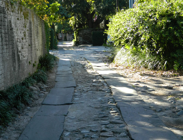
Just below Rainbow Row is Longitude Lane, still paved with cobblestones and about as close to unchanged from 18th Century Charles Town as any location in the old city. This one-block alley runs between Church and East Bay, and the name may derive from its relationship to the maritime concerns of this area in the past. Perhaps the lane was used by the ships docked across Bay Street to take east to west longitudinal bearings before they headed out to sea.
Today the docks are gone but directly across the street from Longitude Lane is the grand neoclassical brick building known as Vanderhorst Row, built in 1800 by the governor of South Carolina from 1792-1794, Arnoldus Vanderhorst.
Go ahead, say the name aloud: VANDROSS! Excellent. Welcome to Charleston!